Wednesday, February 29, 2012

February 29th, Leap Year entry

We left Van Horn, TX and headed East with the wind at our backs. It gives altogether new meaning to the Irish prayer, "May the wind be always at your back." Sometimes the wind blows so hard in West Texas, it stirs up clouds of dust that look like fog.  But it still helps when you are riding East and the sirocco type wind is pushing you up the hills.

In Kent, TX we ran into this couple who are literally walking across America for their cause to help poor villages in Asia. Here is there blog: walkamerica.co.uk.


This is Nick and Lucy from Lincolnshire, UK. That is not a baby carriage but a 3 wheel cart to carry the water they will need crossing Texas.


Here is Nick and Lucy with Jeanne. We presented them with the flag which might help them be visible on the highway.  We had the flag because Travis, who we helped to the bike shop in Las Cruces to get his derailleur fixed, left it in our truck.  Well, why not put it to good use?


And there they go taking a nice stroll along the highway to San Diego, CA.


We are staying at Balmorhea, TX after 60+ miles of riding, and they have a most excellent State Park there.


This is a park with plenty of flowing water which is amazing in this part of the state.


We ran into a couple from Wisconsin who have an A-frame like ours. We had a little comparison chat about them. This is the only other one we have seen.


Tuesday, February 28, 2012

As of February 28th

Sunday we had a wonderful afternoon of riding out of Las Cruces, NM.  Las Cruces is a city of about 100,000 people and has an agricultural base similar to the Imperial Valley in CA. But this area seems to be more prosperous and have a more comfortable way of life. There were lots of bike riders including families, tons of motorcycles, a calm fun loving happy atmosphere we found enchanting. Of course outside the city one cannot escape the smell of farming (read cows, manure, fertilizer, etc.) but overall, it was a pleasant place to visit.


This pecan grove overarched the road and went on for several miles. Many families were riding their bikes along the sides of the road and dozens of motorcycles poured through. It was delightful.


This is a typical middle to upper middle class house in the farming district. Notice the fencing and the bars on the windows. Most houses, be they wealthy, middle class or poor, all have the fencing and physical barriers to entrance. I think it is a throwback to Spain and the European influence. The other thing is most people have dogs and sometimes I got chased. Talk about warming up fast, wow.


After staying overnight in Anthony, NM, we headed into the Lone Star state, Texas.  We now have 1100 miles to go to get to Louisiana, equal to one third of the trip.


We got to Tornillo, TX where we were supposed to find a functioning RV Park. It was not open but they did have a reception committee for Jeanne.  It was Mr. Ed the talking horse.


So we moved on to Ft. Hancock, TX and with nothing doing for an overnight we stayed at the Shell station parking lot, with their permission. No sooner did we get settled in when one 18 wheeler after another pulled in to either get some food at a nearby restaurant, or to take a break and get some sleep. Well, they keep their diesel engines going all night long. Furthermore, at 11:00 P.M. there was a conclave of drivers telling stories about their adventures of the day in excitable voices.  Hey, it was free, safe and much better than nothing. Furthermore, when we started out at 8:00 A.M. the next day, a Border Patrol officer came over to ask if everything was all right. We told him about Tornillo and he said, it was good we didn't stay there, it is a "cartel" town.


Speaking of security, this is a Border Patrol check point. I wasn't supposed to take this picture, but the guard said, "OK, OK, move on!".

 I peddled up to Van Horn, TX on Route I-10 with a fabulous West-East wind at my back. Also, Jeanne and I ran into Erin, the fellow we first saw in Sunrise, AZ,


so I peddled with him for about 50 miles. It was nice to see him again.


Sunday, February 26, 2012

Through February 25th

Since arriving at Silver City we had some interesting developments.  The woman from KOA Jackie Blurton, decided to give Jeanne and I a story on her Facebook and make a donation to the Phoenix Society. We also ran into a woman from Canada named Bev, in a Safeway Store, who questioned why I was in my biking outfit. I told her of the ride across America for the burn society and right on the spot she gave us a donation.

While my bike was being checked out we began a 45 mile trek to the Gila Cliff dwellings. We found the snaking road dangerous especially when, after 20 miles, the narrow virtual one lane road had icy spots, so we found a spot to turn the truck around and came back to Silver City.  It was a ride at your own risk kind of thing.


Talk about hairpin curves.

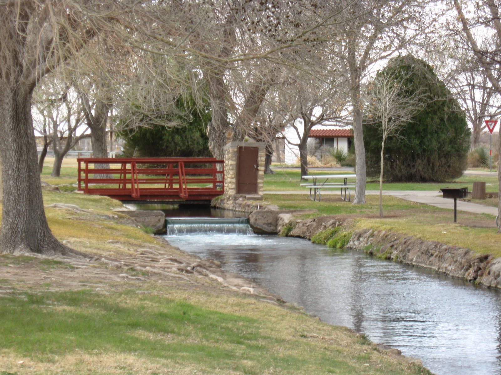
We did get one nice shot at the outset of this ride.


This looks like something from Easter Island.

I had my bike checked out at the Silver City bike shop and their mechanic, Bill (originally from Connecticut) found my chain had stretched. He considered it dangerous to ride and replaced it. This just before my ride up the highest peak on our trip.  PTL.


Bill in Silver City after fixing my bike.

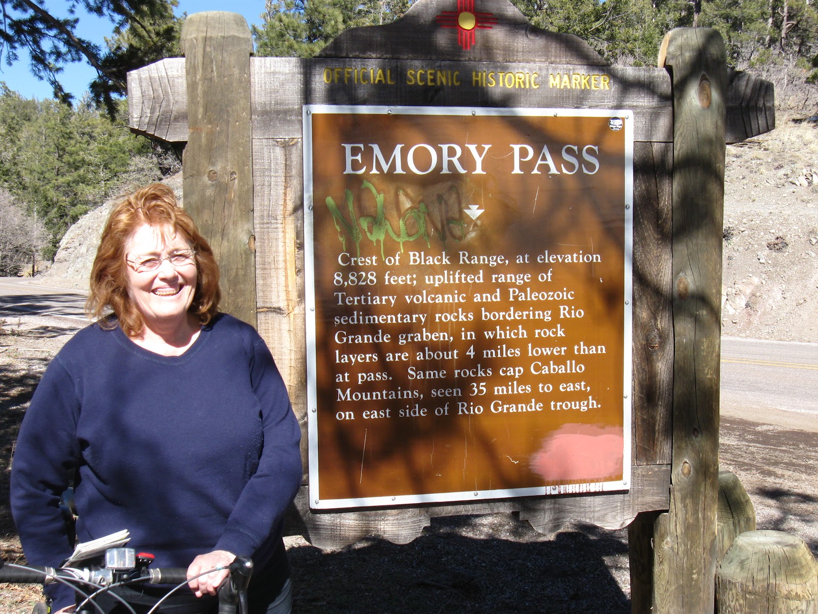
The next morning we were on our way up to Emory Pass and we came across one of the oldest and arguably largest open pit copper mines in the country.


Santa Rita Mine, Silver City, NM.

.
Here is another wider shot.

These are the shots I took on my ride up Emory Pass.


These are "praying hands" or "praying feet". I liked the posture since I needed all the help I could get.


 This is what the road looked like. As they say in sculling: "Stroke, Stroke, Stroke".


This struck me as an interesting formation.


Here's Jeanne 3/4ths of the way up waiting to have lunch.


Then, this other formation caught my eye.


Signs that I was close to the top.


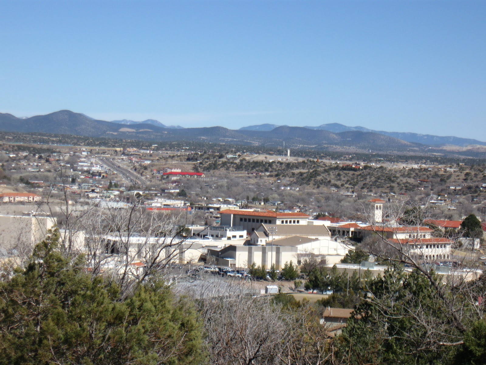
View from the top of Emory Pass, NM. 


Another shot from the top of Emory Pass, NM.


A shot of Jeanne who made it all possible.


I got my chance to mug for the camera.


Then we started down. It now became increasingly cold due to the lack of exertion on my part (coasting down the 7% "S" curves) and the declining power of the sun after 2:00 P.M. at 8,000 feet. My hands began to feel like rocks so I had to stop several times not to lose my grip.


This is the long shot. I actually took this because I could see Jeanne in the truck and camper rolling down the road at slow speed.


The face in the rock near Kingston, NM.


At about 3:30 P.M. we got to Hillsboro, NM.

They have a mine museum there.


We were allowed to camp across the street . . .


 With another home made camper from Ontario, Canada . . .


Where the deer . . .


And the antelope play.


 The next morning we set out for Las Cruces. This was the name of a famous TV program.


Here's a biker going the opposite way.


Here's another biker going my way.


I also came across what looks like a 1952 Chevy similar to the one my Dad had in the '50's.


Then the biker, named Travis, had broken down and needed a new derailleur.  Fortunately, we came by and we were near Las Cruces so we helped him over to the bike shop where they could get him up and going again. This was the second time it happened to him but he had the foresight to buy a spare when it happened the first time so he could fix it quickly.

We got to Las Cruces early enough to get to Saturday night Mass at, get this, St. Albino's Church. It is a very Spanish church but this time the liturgy was in English.  


Wednesday, February 22, 2012

Through February 22nd

We left Safford, shown below,


and headed to a three way intersection in the far eastern section of Arizona. Interestingly enough it is called Three Way and it consists of an old fashion filling station, an old broken down (bars on all windows and doors) general store and a drive-in theater screen. Not much else.


Good example of the wilderness.


There was not a lot to more to see but from this point on the ride it was a 13 mile downhill plunge. Watch out below!

We camped at Valley View RV and took a preview of the second highest peak we were to climb, the  6,288 ft. no name pass in about a 5  mile stretch.


Here is the name of the land area we were in.


This formation looked like a castle.


This one had some character.


Here's one Jeanne called the Lord's foot sticking out of the earth. 


This reminded me of the three monkees: say no evil, see no evil, hear no evil.


This reminded me of a cathederal, like Chartres painted by Monet.


We finally got to the top and this was the rock formation there. It reminded me of those robotic toys called transformers.

Jeanne was waiting for me at the highest mountain I ever biked up. I was mighty pleased to see her. We had lunch in a forest just past the peak and then made the descent to Mule Creek and crossed over from Arizona into New Mexico. This was a very beautiful ride as it remided me of going through the Alps in Switzerland.


Notice the grates in the foreground. These are placed along roadways to keep the cattle form crossing over. When they see it, they refuse to step onto it, apparently for fear of hurting themselves so they stay in bounds. Clever inventor. There's Jeanne waiting for me.


Here's a view of the ride into New Mexico heading towards Buckhorn. Rollling open spaces of grass with a few trees spaced out.  We stayed at Buckhorn and then moved on to Silver City over the Contenental Divide.


Here I am leaning against the sign. The picture was taken by another biker we met, Jackie Blurton, who with her husband Jim own the KOA in Silver City, right where we were heading.


Here's Jackie. I rode with her for a few miles and she is a terrific biker. I couldn't keep up.


Here's shot of Silver City, NM as I came donw the hill into town.  Jackie suggested a bike shop to have my bike looked at by professionals before I climb the next high mountain, 8,230 ft. Emory Pass. Also, my odometer was off and needed to be looked at.  


While at the shop we ran into this very interesting bike I had never seen before. It has extremely fat tires for sand, gravel and other terrain.

Tomorrow we are heading up the road, about 45 miles by truck, to see the Gila Cliff Dwellings where Indians once lived. We will keep you posted.